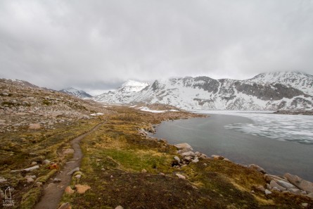
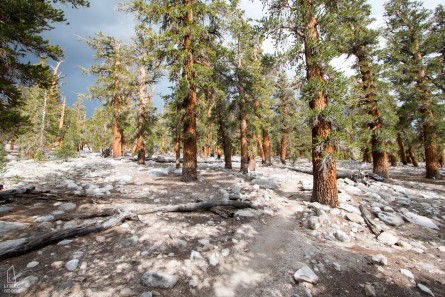
The John Muir Trail’s 220 miles are the prize of the Sierra Nevada and many say of the whole PCT. It’s not surprising given that there isn’t a wasted moment from when the trail rises above the calamity of Yosemite Valley till topping out on Mt. Whitney and descending down the 99 switchbacks to Whitney Portal. The trail winds it’s way through an all-star roster of parks and wilderness areas including: Yosemite National Park, Yosemite Wilderness, Inyo National Forest, Ansel Adams Wilderness, Sierra National Forest, Devils Postpile National Monument, John Muir Wilderness, Kings Canyon National Park, Sequoia National Park, and Sequoia and Kings Canyon Wilderness. The mountainous landscape lends itself to panoramas, but there are also plenty of critters in the mountains. On my trip the most notable sightings were a white-tailed jackrabbit, an american pika, many mule deer and yellow-bellied marmots, a few grouse, and plenty of birds and trout. There were also a good number of fellow hikers on the Pacific Crest Trail hiking north who were always willing to trade details on the conditions at their last pass.
Index
Trip Photos | Trip Logistics | Gear List & Food | Training | Additional Resources
Trip Photos
Trip Logistics
Map Overview (zoom to see highlighted trail)
Permit
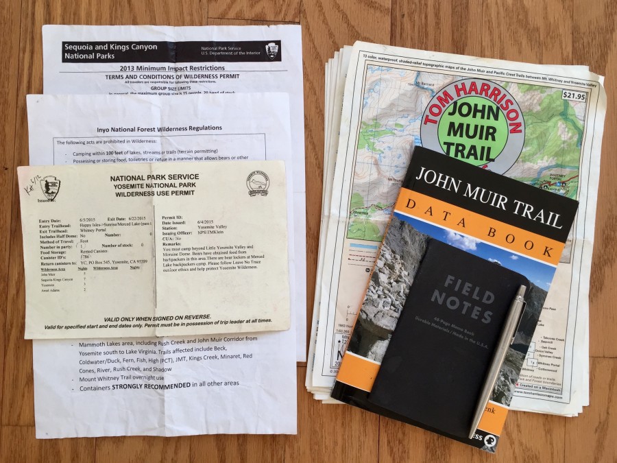
Hiking the JMT requires a permit ($5 + $5/Person), which if you’re hiking from North to South must be obtained in Yosemite National Park. Due to the popularity and low reservation cost of the JMT it’s best to reserve as far in advance as possible (although, if your departure date is flexible, Yosemite resells permits at the wilderness center that remain unclaimed at 10am of that day). The hike from Yosemite south can only be started from four trailheads with limited numbers and the total number of people leaving for Donahue Pass cannot exceed 45 persons per day. The ideal and “true” starting point is at the Happy Isles Trailhead deep in Yosemite Valley. This can sound rather complicated, but the park has a daily updated PDF with a color coded table that makes it very simple. Just scroll down in the PDF, where you’ll see the available dates for Happy Isles and Donahue Pass indicated by cells in the table with a green background. Once you’ve located a date that works, call the office and reserve the time. The Yosemite Wilderness Permit Station is open from 8am to 5pm, and is hard to find, so look at the map to know it’s location in advance if arriving in the afternoon. Bear canisters are also available to rent for $5 at the Wilderness Station with no need for a reservation.
Maps and Planning

Tom Harrison JMT Map Set. $18. Purchase.
Fourteen single-sided, waterproof 8.5″ x 11″ pages. These worked perfectly, every morning I would put the current map and the next map in my pocket and consult at intersections or landmarks. It was always felt good to make it to the second map of the day.
John Muir Trail Data Book by Elizabeth Wenk. $9. Purchase.
Everything you want, nothing you don’t. Trail logistics, elevation profiles, hundreds of campsites with descriptions, maps, labeled peaks in pass panoramas, and milage from both the start and end of the trail to each campsite. Some of the campsites were tucked away off the trail and I never would have found them without this book. Just pop it in a ziplock, since unlike the Tom Harrison Maps, you can’t let this book get wet.
Resupply
There are three location options with varying prices. The ideal location is John Muir Ranch, since it’s barely a detour and is at the midpoint of the hike, however they don’t open until around June 20th and it costs $70. If you’re hiking before this date the options are Reds Meadow for $40 or Vermillion Valley Resort (VVR) for $22. I chose VVR because it was further along the trail (end of day 4) and thus closer to the midpoint. It still required picking up 6 days worth of food which was decently heavy and very very difficult to fit into my rented Garcia bear canister.
Transportation
If you have or can borrow a car, transportation is easy: drive to Yosemite NP and park in the lot labeled Trailhead Parking past Curry Village. There is no time limit, just don’t sleep or leave food in your car. Once you’ve finished the JMT, take a shower at the hostel in Lone Pine and hitch hike back to Yosemite. I’m a bearded 6’6″ man and for both rides it only took about twenty minutes of holding my sign before a kind soul picked me up.
If you don’t have a car, check Craigslist for rides to Yosemite.
Gear List & Food
I’ve broken gear out into a stand alone post.
Additional Resources
Trail & Ultralight Tips
- Yosemite National Park | Leave No Trace Guidelines & Bear Canister Information
- Backpacking North | Ultralight Gear Overview
JMT Resources
- Michael Lanza for Backpacker Magazine | Fastpacking the JMT
- Michael Lanza | Overview of Ultralight Backpacking and JMT Gear List
- JMT Hiker is a great resource for all aspects of the JMT.
- Trail to Summit | Ultimate JMT prep guide.


